
AquaVerify
Citizen Science UX
IEEE Track 1
No jargon. No mandatory accounts. 100% offline. AquaVerify strips away academic gatekeeping, transforming complex stream ecology into a guided, 4-step sensory experience for students, volunteers, and communities.
Why traditional freshwater monitoring tools suffer from 80%+ volunteer abandonment, and how AquaVerify's design philosophy resolves the core tensions between accessibility, precision, and data integrity.
Pushing too hard for Scientific Precision alienates beginners with chemical metrics. Pushing too hard for Simplicity produces arbitrary, useless noise.
Why 80% of amateur monitoring fails in the field
Forms demand "Turbidity in NTU", "DO in mg/L", or velocity in m/s. Beginners feel unqualified and abandon the app immediately.
Apps ask users to estimate numbers on continuous sliders. Uncalibrated human guesses mimic real lab data, poisoning research datasets with invisible noise.
Mandatory fields with no uncertainty escape hatch. Observers standing near murky water under dusk lighting are forced to randomly guess colours.
Single-page forms with 25+ fields cause extreme cognitive overload on glare-heavy phone screens beside slippery, wet riverbanks.
Requires cloud account creation and constant cellular connectivity. Apps crash or hang in ravines, river gorges, and rural wetlands.
Engineered for human psychology, clarity, and field resilience
Parameters are reframed as natural questions: "How clear does the water look?", paired with contextual "Why we ask this" micro-cards.
Embraces discrete, calibrated visual categories (Clear, Slightly cloudy, Very cloudy). Consistent qualitative data is far more useful than fake precision.
Dedicated "Unsure / Cannot tell" option on 100% of indicators. Admitting uncertainty is celebrated as good science that protects dataset veracity.
Splits observation into four bite-sized, thematic steps with a visual progress bar, one-tap chips, and grouped summary review before saving.
Zero login required. Instant platform-native key-value persistence. Operates reliably in airplane mode with one-tap formatted report exports.
Test the complete Flutter application right here in your browser. Click through the 4-step wizard, expand educational cards, test the mandatory ethical disclaimer, and watch observations persist into live browser storage.
Observe water. Understand your surroundings.
IEEE Hackathon • Track 1Simple sensory questions anyone can answer.
Contextual micro-cards teach stream ecology.
Zero accounts. Works deep in river ravines.
Visual data from streams helps watershed groups spot sudden pollution spikes before they harm fish populations.
Offline EXIF photo geotagging and reference calibration colour-cards will be available in the next release.
These records represent citizen visual observations and are not certified laboratory measurements. They should not be used alone to determine water potability or safety.
—
Jump instantly to any stage of the application workflow to inspect specific UX decisions:
Inject representative freshwater test cases into the wizard with one click:
Data is saved locally via localStorage, perfectly mimicking the Flutter app's SharedPreferences offline-first pipeline.
Building AquaVerify was not an exercise in skinning a database. Every screen embodies deliberate critical, creative, and systems design decisions.
Technical indices like Turbidity (NTU) and Hydrological Velocity (m/s) create imposter syndrome in young students and community volunteers. AquaVerify reframes them as intuitive sensory observations without compromising data utility.
Instead of linking to lengthy manuals, warm expandable "Why we ask this" micro-cards deliver bite-sized ecological context right at the moment of observation. Users discover how riffles oxygenate water for aquatic larvae.
When ambiguous lighting or complex water tones make categorization difficult, traditional forms force random clicks, poisoning scientific datasets. AquaVerify provides a prominent "Unsure / Cannot tell" option on 100% of indicators.
Citizen science tools often overlook real riverbank hazards. AquaVerify integrates active cyanobacteria safety alerts in the odour module and enforces a transparent non-certified measurement disclaimer on the review screen.
Monolithic 30-field forms cause severe abandonment on riverbanks. AquaVerify employs progressive disclosure, chunking the workflow into 4 bite-sized thematic steps with high contrast, large touch targets, and pre-selected chips.
Freshwater streams sit in ravines and rural parks where cellular signals drop to zero. Requiring cloud sign-in breaks the user experience in the field. AquaVerify operates 100% offline with platform-native local storage and 1-tap clipboard exports.
How AquaVerify maps academic hydrological parameters into high-consistency citizen questions and ecological rationales without losing scientific utility.
| Scientific Parameter | AquaVerify Plain Question | Standardized Options | Educational Rationale & Ecology |
|---|---|---|---|
|
Turbidity
Unit: NTU / Secchi Depth
|
"How clear does the water look?" |
Why we ask this: Visual estimate of suspended silt.
Ecological Impact: Suspended sediments block sunlight needed by submerged aquatic vegetation (SAV) for photosynthesis and physically clog fish gills.
|
|
|
Chromaticity & Dissolved Matter
Unit: Forel-Ule Scale / Platinum-Cobalt
|
"What colour does the water appear to be?" |
Why we ask this: Detects algal blooms and tannin runoff.
Ecological Impact: Bright green hues signal cyanobacteria or phytoplankton blooms (eutrophication). Brown indicates benign humic acids or severe upstream bank erosion.
|
|
|
Olfactory & Anaerobic Decay
Parameter: Hydrogen Sulfide (H₂S) / VOCs
|
"Do you notice any unusual smell?" |
Why we ask this: Identifies anoxic riverbed conditions.
Ecological Impact: Rotten egg smell signals zero dissolved oxygen (anoxia) at the sediment layer. Chemical or petroleum odours indicate toxic illegal discharges.
|
|
|
Hydrological Velocity
Unit: m/s (Flow rate)
|
"How is the water moving?" |
Why we ask this: Evaluates oxygen entrainment via riffles.
Ecological Impact: Tumbling riffles aerate the water column, supporting oxygen-sensitive mayflies and trout. Stagnant water heats rapidly and loses carrying capacity.
|
|
|
Solid Anthropogenic Waste
Index: Macro-debris count
|
"How much visible litter or trash do you notice?" |
Why we ask this: Pinpoints illegal dumping hot-spots.
Ecological Impact: Plastics leach phthalates and break down into microplastics that bioaccumulate across the freshwater food web.
|
|
|
Riparian Buffer Zone Integrity
Metric: Vegetative bank coverage
|
"What do you notice around the water (Vegetation)?" |
Why we ask this: Assesses bank stabilization and shading.
Ecological Impact: Canopy shade keeps water cool (crucial because cold water holds significantly more dissolved oxygen). Root networks filter agricultural nitrogen.
|
|
|
Catchment Basin Land Use
Classification: Corine Land Cover
|
"What best describes the surrounding area?" |
Why we ask this: Identifies external pollution drivers.
Ecological Impact: Impervious urban concrete causes flash floods carrying vehicle oil residue. Agricultural catchments introduce high fertilizer loads causing algal blooms.
|
Pixel-perfect screen captures from the release build running on Android and desktop emulators. Click any card to inspect in high resolution.
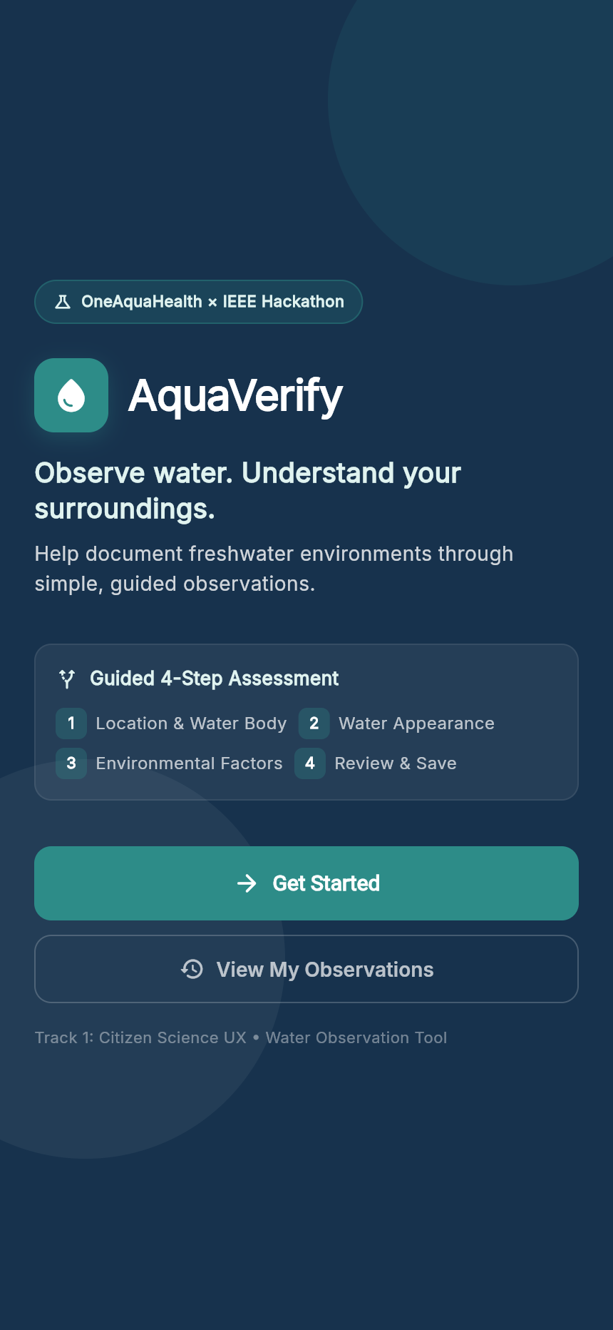
First-touch onboarding establishing identity, zero-login promise, and instant entry.
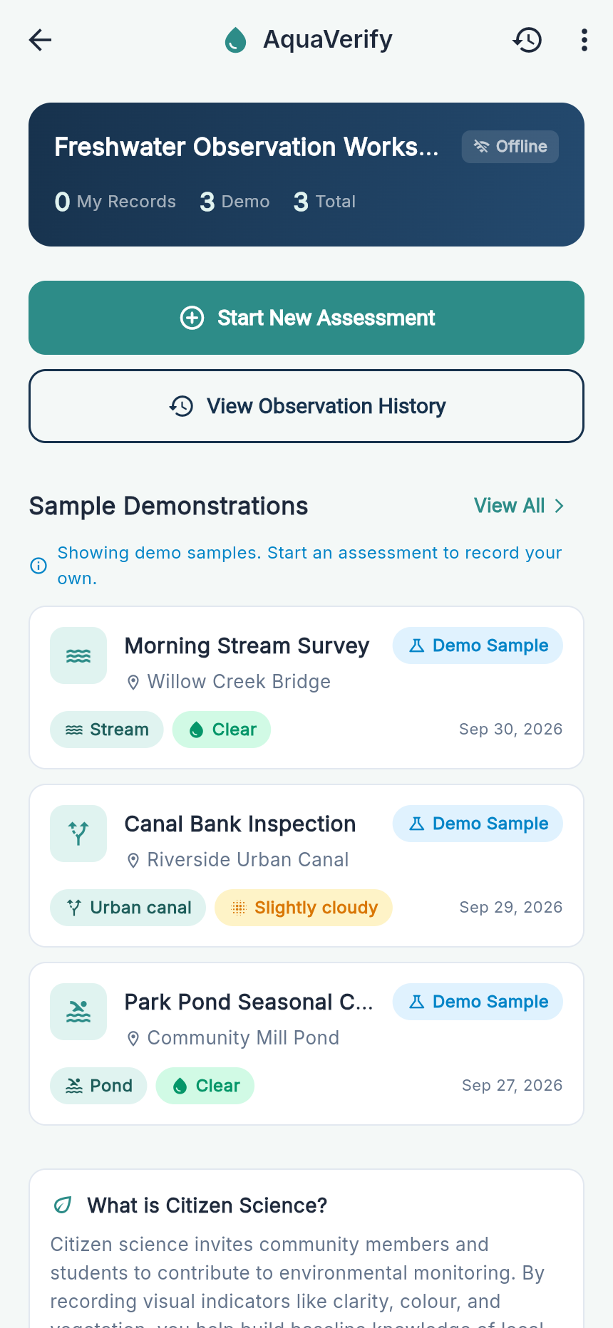
Contribution counters separating Citizen Observations from pre-seeded Demo Samples.
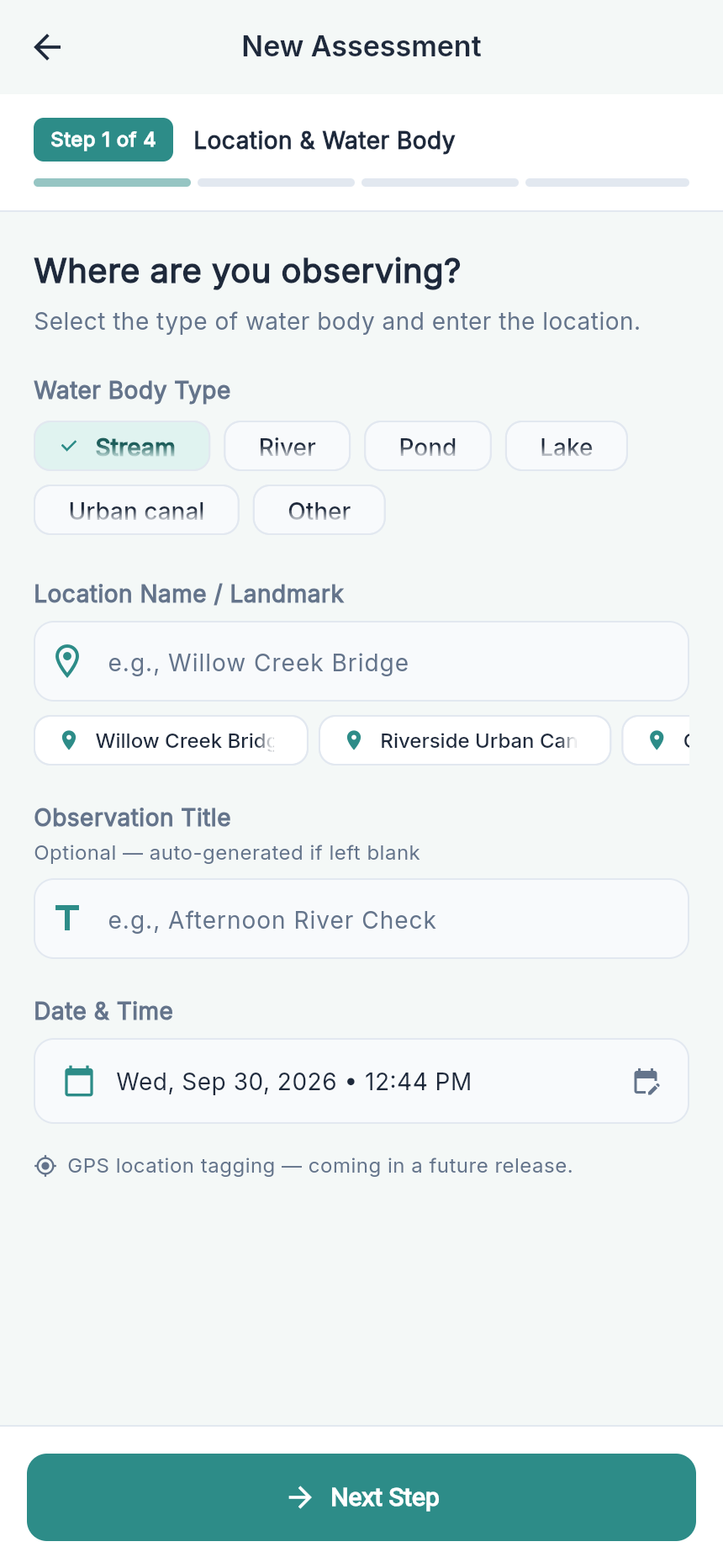
Quick-select chips for representative habitats with instant error validation.
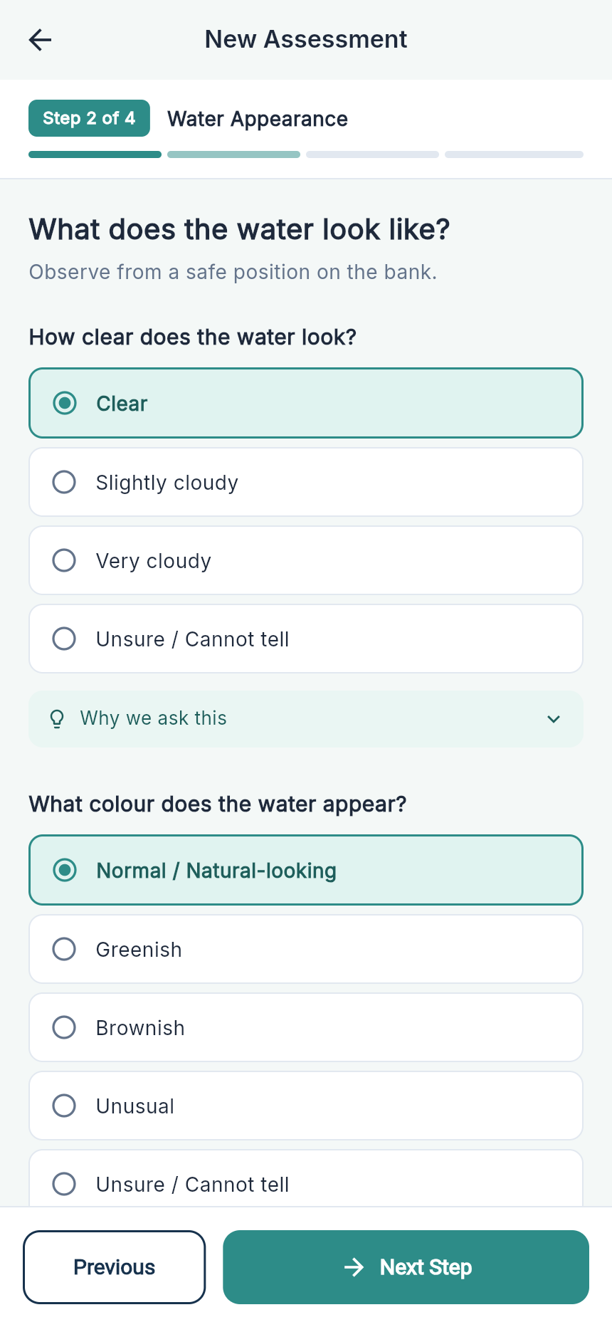
Turbidity and colour sensory questions with active physical safety reminders.
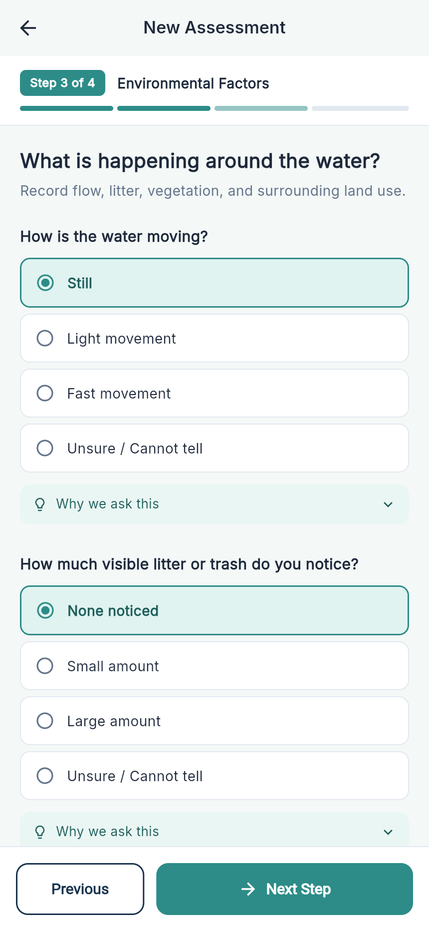
Stream flow, visible litter, and riparian vegetation micro-educational guidance.
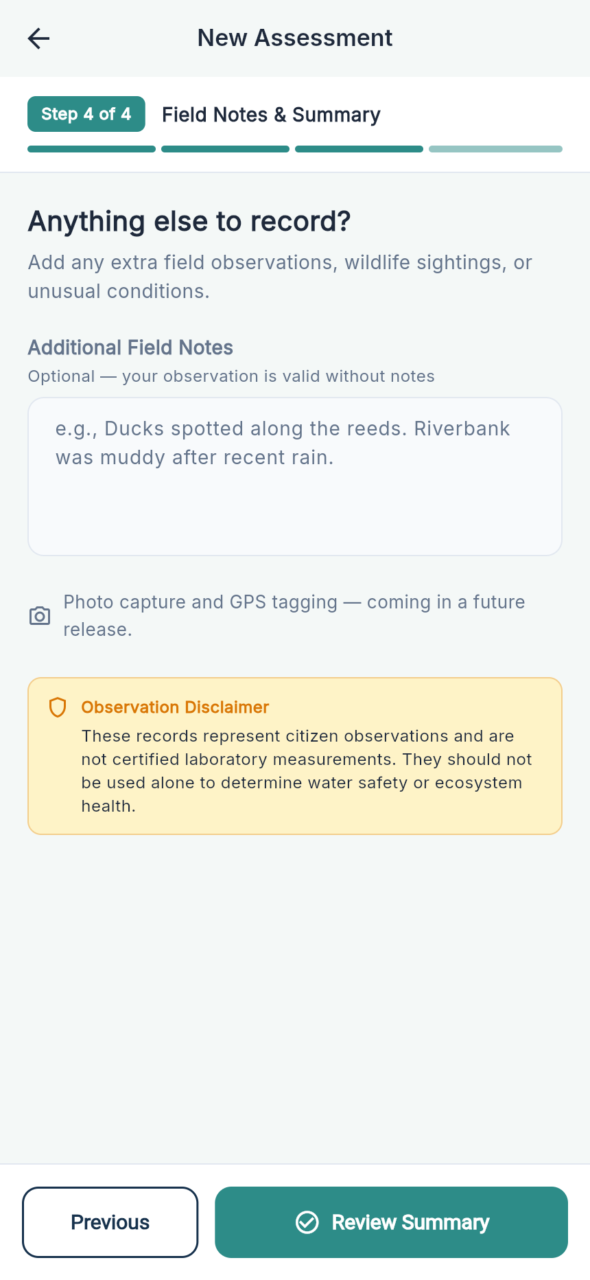
Wildlife logging and preview of upcoming offline EXIF photo geotagging.
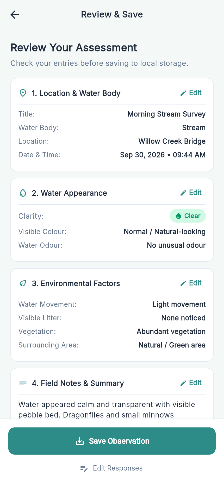
Grouped sections, debounce save mutex, and mandatory ethical transparency checkbox.
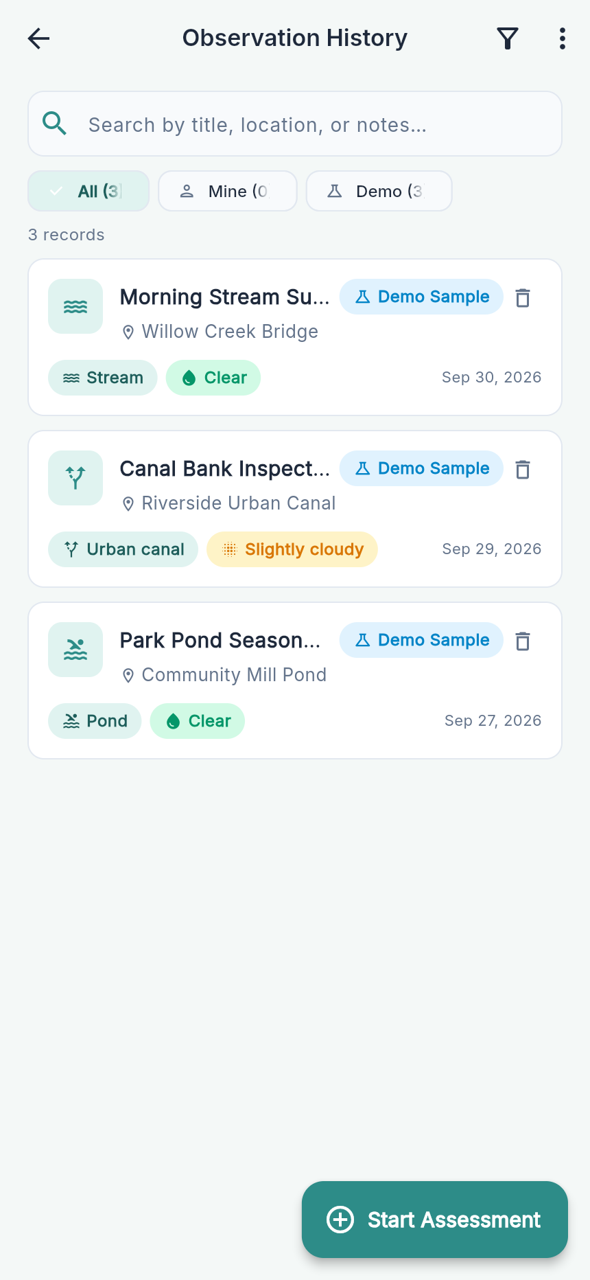
Real-time keyword search across titles and notes with 3-way data scope isolation.
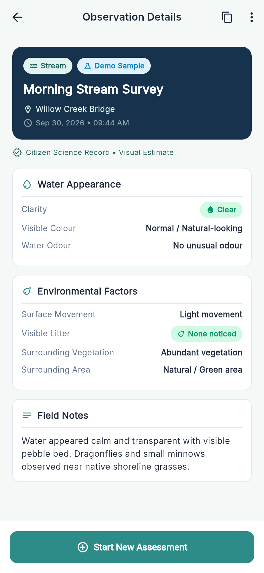
Complete record readout with one-tap formatted ASCII clipboard report generator.
A structured 3-minute video presentation demonstrating how AquaVerify eliminates scientific gatekeeping and delivers an ethical citizen science experience.
Target duration: 3:30 • Track 1: Citizen Science UX • OneAquaHealth × IEEE Hackathon
Direct access to the production Android release artifact (v1.0.0+1) and the clean, zero-bloat Flutter repository architecture.
Compatible with all modern Android phones and tablets. Direct install without Google Play dependency.
AquaVerify is engineered for longevity and rock-solid performance, avoiding heavy external state libraries that create version fragility.
ValueListenableBuilder with zero external dependencies.isDemo: bool).Direct answers addressing data quality heuristics, ethical boundaries, and offline reliability for hackathon judges and researchers.